30. August 2021
How thousands of Points become an Interior Architecture Plan
To achieve our commitment to the highest precision, we use a 360-degree laser scanner for site measurements. Based on thousands of data points, we then create detailed plans.

Author
Thomas Baumgartner
Every project begins with taking measurements – the foundation for all subsequent steps. Precision is critical. To ensure the highest accuracy and efficient processes, we rely on a combination of digital and manual techniques.
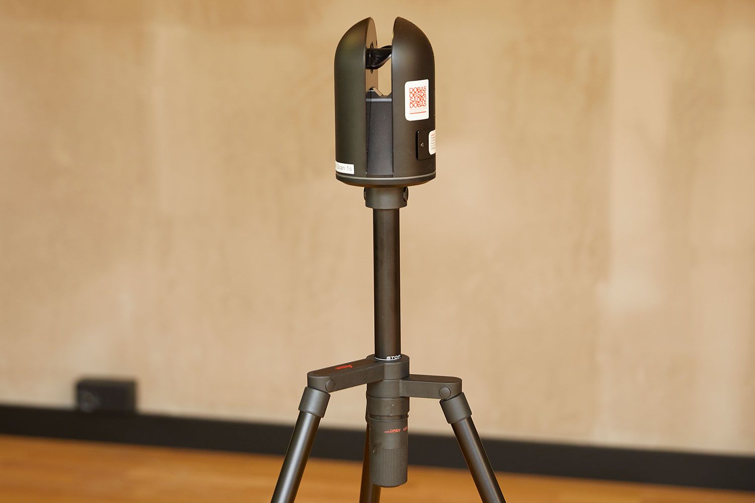
Small size, enormous help
A 360-degree laser scanner is a relatively compact device: it has a diameter of just 11 centimetres and stands 20 centimetres tall. When mounted on a tripod, it reaches a height of 110 centimetres. On-site, we carry the lightweight 1.5-kilogram device in a small bag.
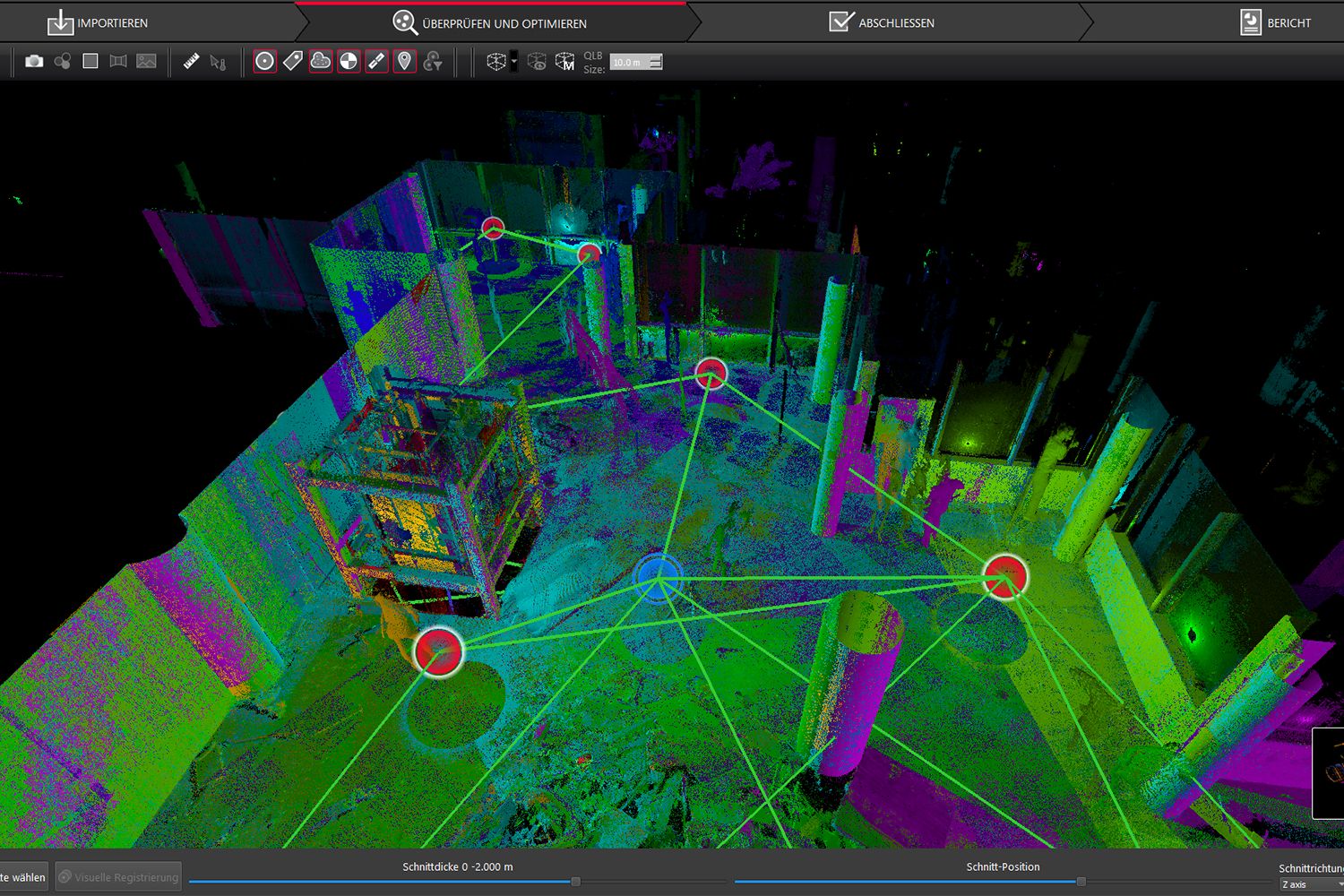
At the site, the laser scanner is positioned in several strategically chosen locations. At each position, an integrated digital camera first captures a full-colour panoramic image. Then the scanning process begins: using a rotating mirror and a laser beam, the device collects tens of thousands of data points, forming what’s known as a point cloud. This process takes only three to four minutes per location.
The more complex the object – such as a highly intricate or irregularly shaped room – the more scanning locations are required. To ensure accuracy, we also measure critical components manually with a distance laser. This dual measurement approach is particularly valuable as DOBAS often operates internationally. Many of our construction sites are abroad, making it essential to minimise the need for return trips to verify measurements.
For this reason, the project manager conducting the measurement typically sends the scanner data to our planners in Lucerne before returning. This allows the team to quickly verify the data’s integrity and confirm that all necessary information has been captured.
At the computer, but as if on-site
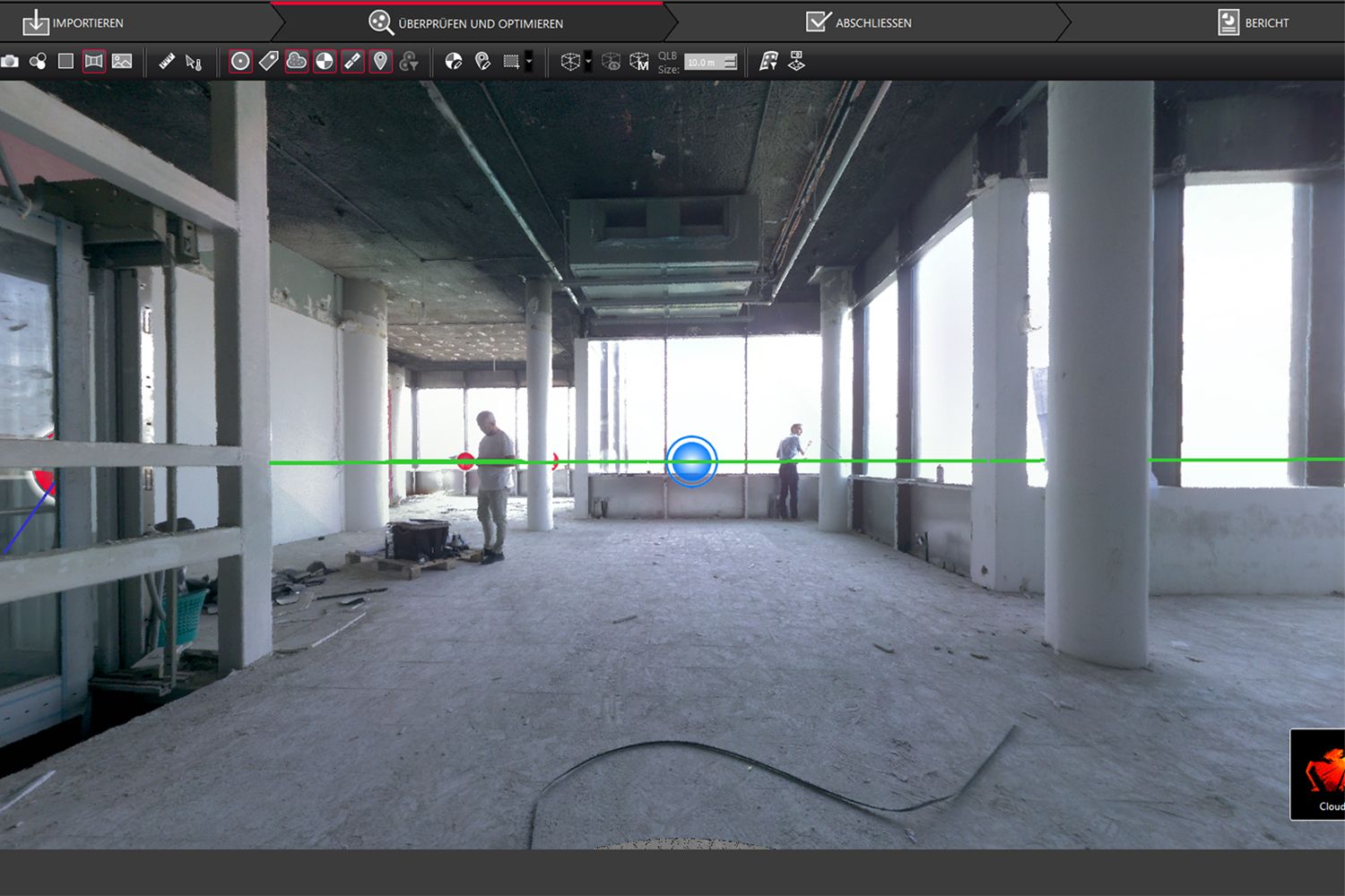
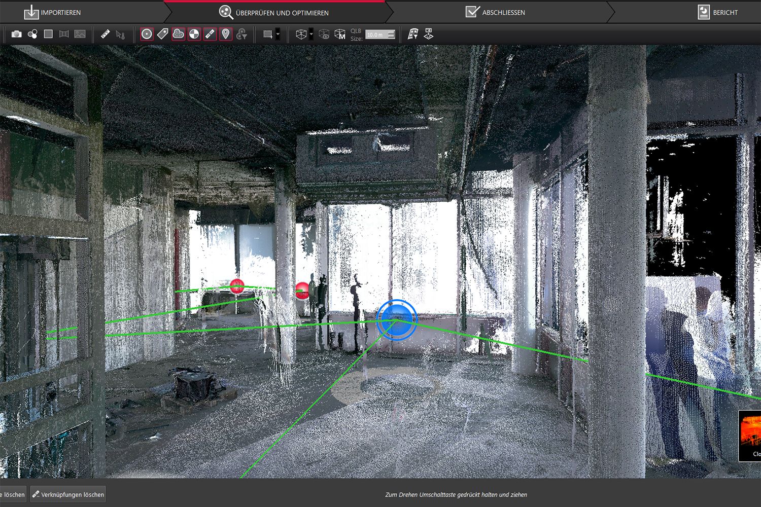
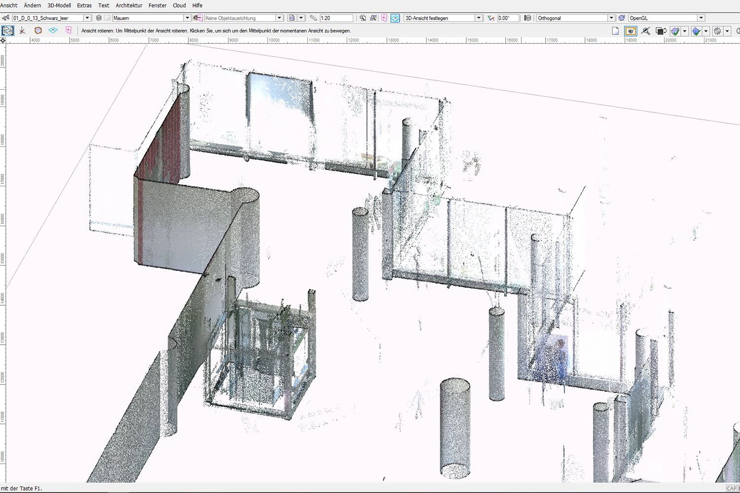
Once the environmental data from the various scanning locations and the visual information are imported, the software generates a 3D model of the space. Put simply, the program combines the data sets, aligns the point clouds, and overlays the panoramic images. Users can then explore the object on their screens, viewing it from different angles and navigating through it. Depending on the zoom level, various details become visible (see images).
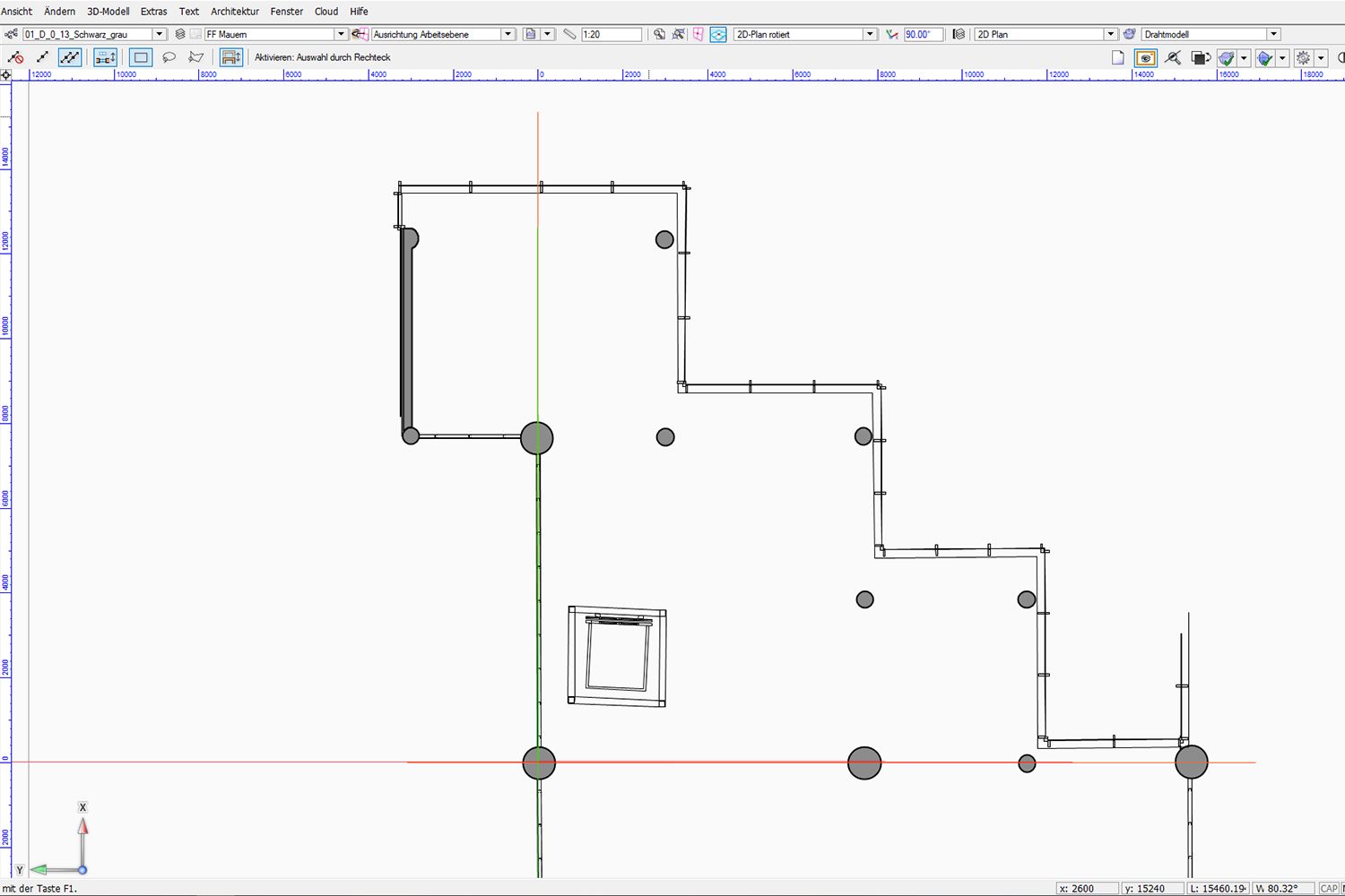
From 3D to 2D
The information from the 3D point cloud is manually transferred by our planners into our CAD software. CAD stands for computer-aided design.
In CAD, a two-dimensional record of the site is created. This serves as the central reference point for all parties involved in the project, including interior architects, specialist planners, and manufacturers. Manufacturers, in turn, further process the plans into production drawings – increasingly in digital form.
Take your interior architecture project to the next level
Thomas Baumgartner
Project Manager
Explore More Space Stories
Space Story #9 | 26 November 2020
Virtual Reality for Brand Acquisition
DOBAS employs Virtual Reality (VR) to visualise future retail spaces, among other applications. This technology offers various opportunities and can prove particularly valuable in brand acquisition.
Space Story #51 | 21 November 2025
Design and the Guest Experience: Insights from the Swiss Hotel Industry
A recent study by the HSLU Lucerne School of Business and studio Design-Journey shows: customer-centric design not only improves the experience in the hotel industry but also increases business success. In other words: design matters – emotionally and economically.